Interactive maps are an incredible tool for web developers and users alike. They allow developers to showcase data visually in a way that is easy for users to understand and interact with. The benefits of creating interactive maps with HTML and JavaScript are numerous, including increased engagement, improved user experience, and enhanced data visualization.
HTML is the standard markup language used for creating web pages, and JavaScript is the most popular programming language for creating interactive web applications. When combined, these two technologies allow developers to create dynamic and interactive maps that are easy for users to use and understand.
One of the significant benefits of using HTML and JavaScript to create interactive maps is the level of customization and control that developers have over the map’s design and functionality. By using these technologies, developers can create a map that meets the specific needs of their users and fits seamlessly into their website’s design and layout.
Moreover, interactive maps created with HTML and JavaScript can be easily updated and modified as needed. This means that developers can continuously refine and improve the map over time to ensure it remains relevant and useful to its users.
In summary, creating interactive maps with HTML and JavaScript is an excellent way to enhance the user experience, improve data visualization, and increase engagement. By using these technologies, developers can create customized, dynamic, and interactive maps that meet the specific needs of their users and fit seamlessly into their website’s design and layout. So, let’s dive into the steps involved in creating an interactive map with HTML and JavaScript.
Planning: Identifying Necessary Data and Tools

When it comes to creating interactive maps with HTML and JavaScript, planning is key. Before diving into the design and styling aspects, it’s important to identify the necessary data and tools that will be used to bring the map to life.
The first step in planning is to determine what data will be included on the map. This can range from simple location markers to complex overlays that display specific information when clicked. It’s important to think about the purpose of the map and what information the user will need to see in order to achieve that purpose.
Once the necessary data has been identified, the next step is to determine what tools will be used to create the map. There are many options available, from third-party libraries to custom-built solutions. It’s important to consider the level of customization and interactivity that is desired, as well as the technical expertise required to implement the chosen tools.
Another important aspect of planning is considering the performance implications of the chosen tools. Interactive maps can be resource-intensive, particularly if they include large amounts of data or complex features. It’s important to strike a balance between functionality and performance to ensure a smooth user experience.
Ultimately, the planning phase is all about setting a solid foundation for the map-building process. By identifying the necessary data and tools up front, developers can avoid costly delays and ensure that the map meets their desired specifications. So take the time to plan thoroughly, and the rest of the map-building process will be much smoother and more enjoyable.
Ultimately, the planning phase is all about setting a solid foundation for the map-building process.
Design and Styling: Creating Eye-Catching Interactive Maps with HTML and CSS

When designing an interactive map, it’s important to consider not just functionality, but also aesthetics. After all, a map that is visually appealing is more likely to draw in users and keep them engaged. Thankfully, with HTML and CSS, it’s easy to create a map that is both functional and attractive.
One key consideration when designing an interactive map is the color scheme. Choose colors that are pleasing to the eye and that complement each other well. Consider using shades of blue and green to denote bodies of water and green spaces, respectively. For built-up areas, you might choose to use shades of gray or brown.
Another important aspect of design is the font choice. Select a font that is legible and easy to read, even at small sizes. Sans-serif fonts such as Arial and Helvetica are typically a safe choice.
When it comes to styling your map, CSS is your friend. Consider using borders and drop shadows to make your map elements stand out. You might also experiment with different background colors or patterns to make your map more visually interesting.
One thing to keep in mind is that the size of your map can have a big impact on its usability. Avoid making your map too small, as this can make it difficult for users to read labels or click on markers. Conversely, a map that is too large can be overwhelming and may not fit well on the screen.
Overall, designing an interactive map with HTML and CSS requires a balance of aesthetics and functionality. By carefully choosing your colors, fonts, and styles, you can create a map that is both visually appealing and easy to use. So don’t be afraid to experiment and try out different design elements – the possibilities are endless!
Avoid making your map too small, as this can make it difficult for users to read labels or click on markers.
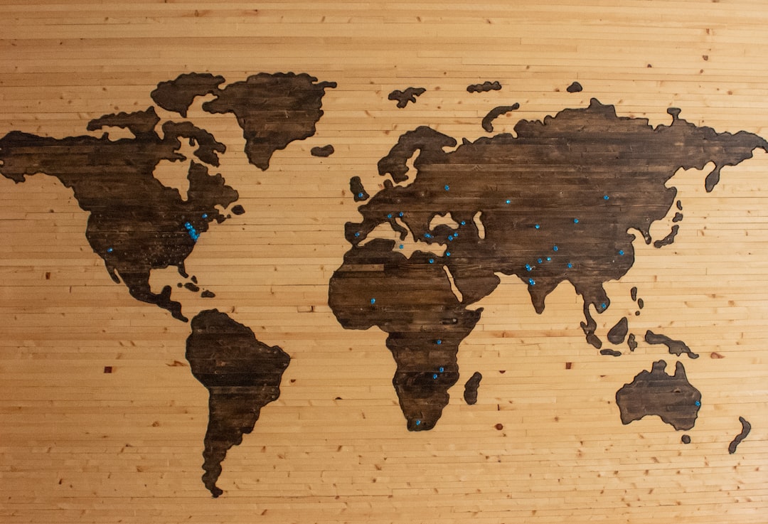
Data and Markers: Incorporating Your Data into the Map

As we’ve discussed in the previous section, designing the map is only one aspect of creating an interactive map with HTML and JavaScript. To truly make the map interactive and useful, you need to incorporate your data and markers into the map.
Before you start coding, you’ll need to identify the data you want to include on your map. This could be anything from population data to geographic markers to business locations. Once you have your data, you’ll need to format it in a way that can be easily read by JavaScript.
One of the most common ways to incorporate data into a map is through the use of markers. Markers are icons or symbols that are placed on the map to represent data points. For example, if you were creating a map of your city’s restaurants, you could use markers to represent each restaurant’s location.
To add markers to your map, you’ll need to use JavaScript. There are a variety of JavaScript libraries available that can help you add markers to your map, such as Leaflet and Google Maps API. These libraries provide pre-built markers that you can customize to fit your needs.
Once you have your markers set up, you’ll need to bind your data to the markers. This means that each marker on the map corresponds to a specific data point in your data set. When a user clicks on a marker, you can display additional information about that data point, such as the name of the restaurant or the population of a specific area.
Overall, incorporating your data and markers into your map can take some time and effort, but it’s well worth it. Not only does it make your map more useful and informative, but it also provides a great user experience for your visitors. So don’t be afraid to experiment and customize your map to fit your specific needs.
Markers are icons or symbols that are placed on the map to represent data points.
Adding Interactivity to Your Interactive Map

Now that you have designed and added markers and data to your map, it’s time to add some interactivity. This will allow users to click, zoom, and interact with the map in a more dynamic way. Here are some tips for adding interactivity to your interactive map:
1. Zooming: One of the most basic forms of interactivity is allowing users to zoom in and out of the map. You can add this feature using the zoom property in JavaScript. This will allow users to zoom in and out of the map using the scroll wheel or buttons.
2. Clicking: Another way to add interactivity is to allow users to click on markers or other elements on the map. You can use the onClick event in JavaScript to trigger actions when a user clicks on something. For example, you could display more information about a location or open a link to a website.
3. Filtering: You can also add interactivity by allowing users to filter the data on the map. This can be done using checkboxes, dropdown menus, or other input elements. You can use JavaScript to filter the markers or data based on user input.
4. Customization: Finally, one of the best things about creating an interactive map with HTML and JavaScript is the ability to customize it to fit your own needs. You can experiment with different types of interactivity and find what works best for your particular map. Don’t be afraid to try new things and see what works best for you!
Remember, adding interactivity to your interactive map can make it more engaging and useful for users. By following these tips and experimenting with different forms of interactivity, you can create a truly unique and dynamic map that meets your specific needs.
This will allow users to zoom in and out of the map using the scroll wheel or buttons.
Testing and Debugging

When it comes to creating interactive maps with HTML and JavaScript, testing and debugging are critical processes that must be taken seriously. Failing to properly test and debug your map can lead to issues that could potentially ruin the user experience. In this stage, you need to make sure that everything is working correctly and that the map is functioning as intended.
One of the most important tips to keep in mind when testing your map is to test it on different devices and browsers. This is because different browsers and devices may interpret your code differently, which can lead to unexpected behavior. To ensure that your map works on all devices and browsers, test it on as many platforms as possible.
Another tip is to use console.log() statements to debug your code. This function allows you to output messages to the browser console, which can be helpful when trying to debug your code. By logging messages at different points in your code, you can identify where issues may be occurring and fix them accordingly.
In addition, it’s important to test your code in a controlled environment. By this, we mean testing your map in an environment that closely mimics your intended use case. For example, if you anticipate your map being used on slow internet connections, test it on a slow connection to ensure that it loads quickly and smoothly.
Lastly, it’s a good idea to get feedback from others. Show your map to friends, colleagues, or even strangers and ask for their opinion. This will help you identify any issues that you may have missed and can ultimately lead to a better user experience.
Remember, testing and debugging are important steps in the process of creating an interactive map with HTML and JavaScript. By following these tips, you can ensure that your map works properly and provides a great user experience. So, test away and don’t be afraid to experiment and customize your map to make it fit your individual needs.
Remember, testing and debugging are important steps in the process of creating an interactive map with HTML and JavaScript.
Conclusion: Creating Your Custom Interactive Map with HTML and JavaScript
Congratulations on making it to the end of this blog post! We hope you’ve found the information provided valuable and informative. Now that you’ve gone through the various steps involved in creating an interactive map with HTML and JavaScript, it’s time to put your knowledge to the test.
To recap, we started by introducing the concept of interactive maps and the benefits of creating them with HTML and JavaScript. We then discussed the importance of planning the map, identifying the necessary data and tools, designing and styling the map with HTML and CSS, and incorporating data and markers with JavaScript. We also explored the various ways to add interactivity to the map, such as zooming and clicking, and provided tips for testing and debugging the map to ensure it works properly.
Now that you know the basics, it’s time to experiment and customize the map to fit your individual needs. There are countless possibilities for creating unique and engaging interactive maps, so don’t be afraid to let your creativity run wild. Whether you’re building a map for your personal website, business, or community organization, the possibilities are endless.
In conclusion, creating an interactive map with HTML and JavaScript may seem like a daunting task, but with the right tools and knowledge, it can be a fun and rewarding experience. So get started today and see what kind of amazing maps you can create!